A warm mid-winter for most of New Zealand.
Overview
Mean sea level pressure was below normal to the southwest of New Zealand and above normal to the east and north of the country. This led to more northwesterly air flows than normal and allowed warmth from the sub-tropics to occasionally push down toward New Zealand. The pattern led to abundant rainfall across the western South Island, but very dry conditions occurred in the east of both islands which were shadowed by the Southern Alps and Central Plateau, respectively.
During July, there was a notable dichotomy of rainfall anomalies experienced in the South Island. Fiordland, the West Coast, and the Tasman District saw several very heavy rainfall events through the month, with nearly 200% of normal July rainfall recorded in some locations. To the contrary, several locations in northern Canterbury recorded less than 20% of the normal July rainfall, a pattern that carried across the Cook Strait and affected areas of Hawke’s Bay and Gisborne. Although the Coromandel Peninsula received one heavy, flooding rainfall event, July monthly rainfall totals were largely below normal.
Temperatures during the month of July were warmer than average for a large part of the country, especially in the South Island. Northwesterly air flows periodically carried warmth across the Tasman Sea from Australia, which warmed further as it descended the eastern slopes of the Southern Alps, with numerous near-record mean monthly temperatures recorded. Seven towns recorded their warmest July on record in terms of mean maximum (daytime) temperature. Compared to June, July also had more sunshine hours for many eastern areas; a welcome reprieve after a dreary start to the winter season and a pattern that supported anomalous warmth.
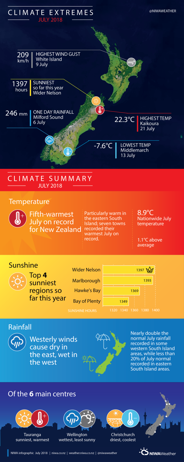
The nationwide average temperature in July 2018 was 8.9°C (1.1°C warmer than the 1981-2010 July average from NIWA’s seven station temperature series which begins in 1909). Based on the seven station series, July 2018 was the fifth-warmest July on record behind 1998, 2000, 2005, and 2013.
Further highlights:
- The highest temperature was 22.3°C, observed at Kaikoura on 21 July.
- The lowest temperature was -7.6°C, observed at Middlemarch on 13 July.
- The highest 1-day rainfall was 246 mm, recorded at Milford Sound on 6 July.
- The highest wind gust was 209 km/h, observed at White Island on 9 July.
- Of the six main centres in July 2018, Tauranga was the warmest and sunniest, Christchurch was the coolest and driest, and Wellington was the wettest and least sunny.
- Of the available, regularly reporting sunshine observation sites, the sunniest four regions in 2018 so far (1 January – 31 July) were Wider Nelson (1397 hours), Marlborough (1393 hours), Hawke’s Bay (1369 hours) and Bay of Plenty (1349 hours).
- Of the available, regularly reporting low elevation rainfall sites, the top two wettest locations in 2018 so far (1 January – 31 July) were Milford Sound (4442 mm) and Manapouri (2650 mm). The top two driest locations in 2018 so far were Alexandra (270 mm) and Eglinton (290 mm).
Contact:
Ben Noll, Meteorologist Tel. 09 375 6334
Download:
- July 2018 Climate Summary information [PDF 1.26 MB]
- July 2018 Climate Statistics [PDF 63KB]

