-

Droughts
Generally speaking, a drought is defined as a rainfall deficit which restricts or prevents a human activity – for example, farming or power generation. -

Canterbury Wave Conditions
Software Tool/ResourceNIWA run a computer model which simulates wave heights across the Canterbury continental shelf and along the coast. -

Climate change scenarios for New Zealand
Research ProjectProjections of how climate change is likely to affect New Zealand. -
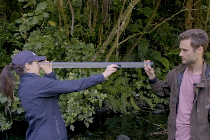
SHMAK water quality – visual clarity
There are two methods to determine visual clarity in SHMAK; the clarity tube (or SHMAK tube) and the black disc method. -

Dissolved oxygen
Dissolved oxygen (DO) is a relative measure of the amount of oxygen (O2) dissolved in water. -
New Zealand rushes (Juncus): factsheets and key
New Zealand rushes (Juncus): species-level factsheets. -

UV Index Information
The UV Index is a measure of the intensity of UV radiation. The larger the number, the more intense the UV. In New Zealand, its maximum summer value is generally about 12, but it can exceed 13 in the far North. In winter it reaches peak values of 1 or 2. Values of 10 or more should be considered as "extreme". At high altitude tropical sites (eg Mauna Loa Observatory, Hawaii), the UV Index can exceed 20.The UV Index supersedes the idea of "Time to Burn" or "Burn Time", which has been used previously in New Zealand. -

Chemical contamination and wastewater
What are the potential sources of chemical contaminants in wastewaters? -

Nature knows best?
Feature story06 June 2017Returning water to our waterways after we’ve used it in our homes, on farms and in industry is a complex and challenging process. -

Water diversion
Diverting water away from its natural channel for commercial or private use. -
Sediment and urbanisation
How does urbanisation increase sediments in waterways? -

Submerged plants as bio-indicators
Submerged plants have a number of advantages that favour their use as indicators of lake ecological condition.