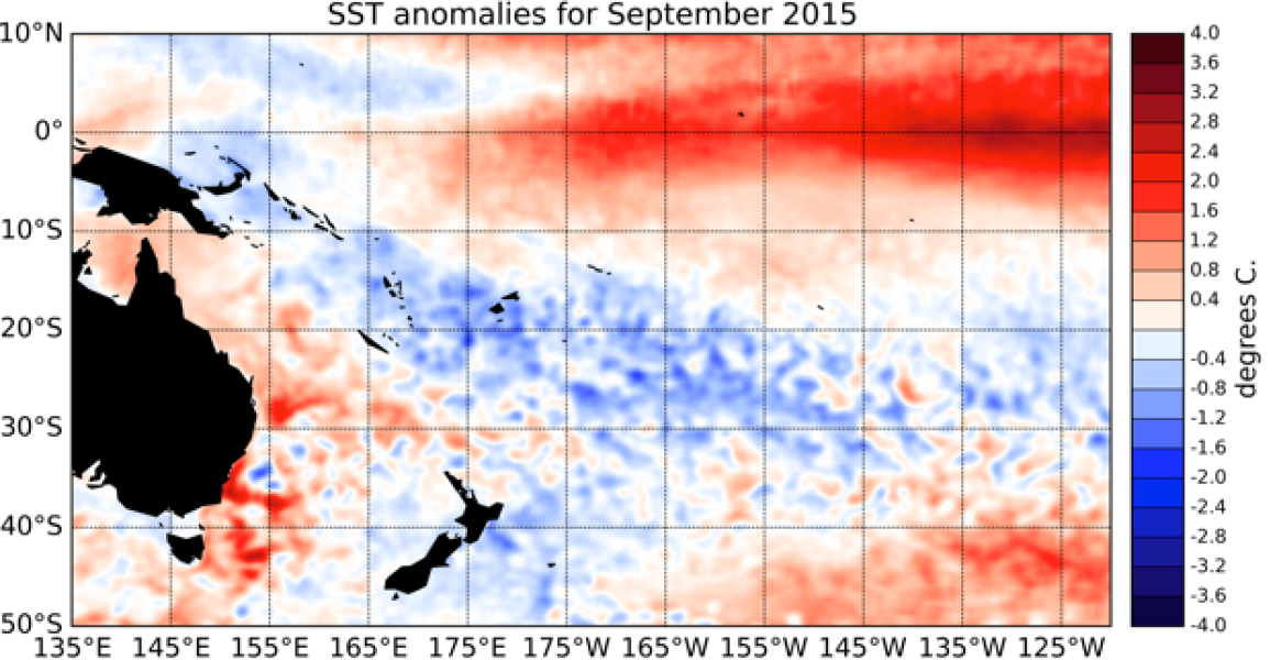
Strong El Niño conditions were established during September 2015. Sea surface temperature (SST) anomalies in the NINO3.4 region are close to +2°C (+1.96°C), while they exceed this threshold in the NINO3 region (eastern Pacific: 90oW – 150oW), with the latest monthly value reaching +2.12°C.
The NINO4 index (in the western Pacific) remains stable at +1.1°C. Sub-surface ocean temperatures in the eastern Pacific have remained much higher than normal, with anomalies exceeding +7oC off the South American coast (east of about 120oW and at about 75m depth). The atmosphere remained fully coupled to these ocean anomalies. The Southern Oscillation Index (SOI) was strongly negative (-1.7 for September 2015), and westerly wind anomalies (weaker trade-winds) dominated the central and western equatorial Pacific. Consistent with these patterns, convection and rainfall was suppressed over Indonesia and large parts of the Maritime Continent, while enhanced convective activity and rainfall were observed in the central and eastern Equatorial Pacific.
The South Pacific Convergence Zone (SPCZ) was again this month mostly suppressed in the southwest Pacific, and the Inter-Tropical Convergence Zone (ITCZ) was displaced towards the Equator in the eastern Pacific. The ENSO Precipitation Index (ESPI) reflects strong El Niño conditions with a value of +2.25 (value to the 30th of September).
The Madden-Julian Oscillation (MJO) was mostly inactive over the western Pacific during the past two weeks. At the forecast horizon of 14 days, the dynamical and statistical CPC forecasts somehow diverge, but the MJO signal is expected overall to remain weak. International guidance indicates that El Niño conditions are virtually certain (99% chance) to continue over the next three month period (October – December 2015) and highly likely (95% chance) to carry on through the summer (January – March 2016).

