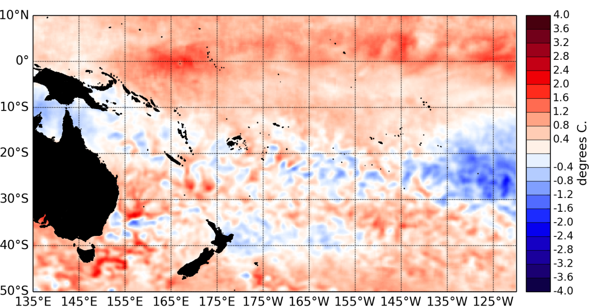
During November 2014, Equatorial sea surface temperatures (SSTs) steadily increased across the equatorial Pacific ocean and all NINO indices have now crossed the conventional El Niño thresholds. Some atmospheric indicators also show signs consistent with a weak El Niño developing.
The latest monthly anomaly values for the NINO SST indices are: +0.9 for NINO3.4 (up from +0.53°C in October), +0.92°C for NINO3 (up from +0.68°C last month), and +1.02°C for NINO4 (was +0.75°C in October).
Ocean sub-surface temperatures that were present in the central Pacific propagated eastward and reached anomalies of around +4°C at 120°W and 100m depth. Oceanic heat content (0 to 300m depth) also increased in the eastern Pacific to reach about +2°C around 120°W.
The Southern Oscillation Index (SOI) is at –1 for November 2014. However patterns of convection and rainfall have not yet caught up and in November convection was actually reduced in the central Pacific, a pattern opposite of El Niño. The latest value for the TRMM ENSO index for the 30 days to 3 December is indeed slightly negative at –0.38 (La Niña side of neutral).
A strong Madden – Julian Oscillation (MJO) pulse reached into the Maritime Continent in the last days of November and is forecast to propagate further eastward at least over the next week or so. The region of enhanced convection and rainfall associated with this event could tip the atmosphere towards a more definitive weak El Niño state.
The consensus ENSO forecast from the IRI / CPC indicates that the chance of El Niño developing over the December 2014 – February 2015 period is 75%, a sharp increase compared to ENSO forecasts issued last month.

