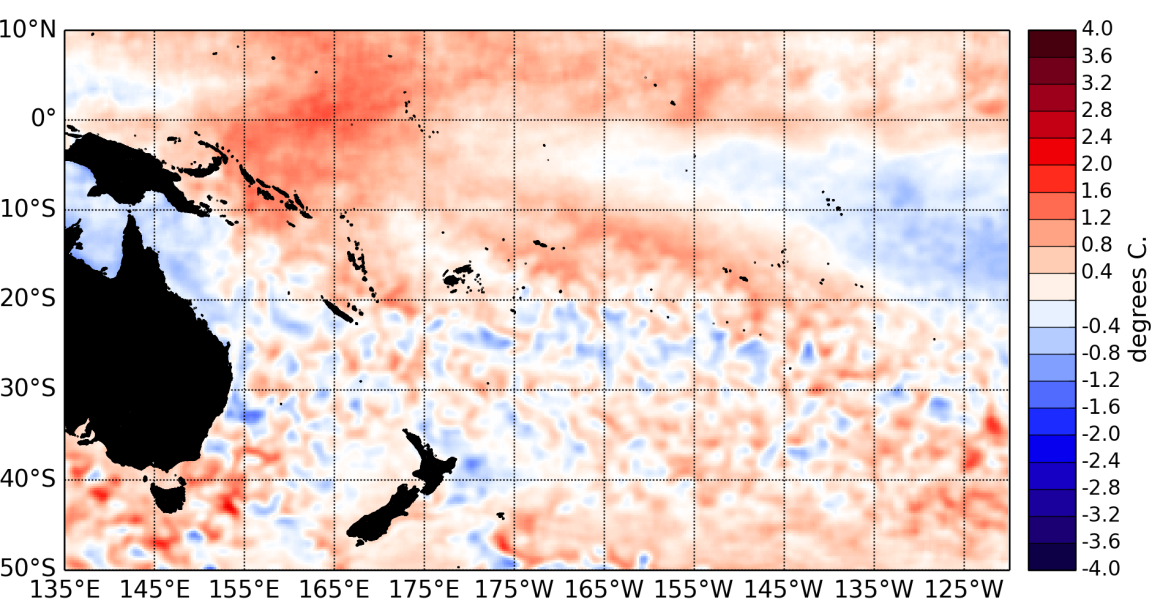
During September 2014, borderline El Niño conditions returned in the Pacific Ocean. Equatorial sea surface temperatures (SSTs) rose in the western and eastern Pacific.
The latest monthly anomaly values for the NINO SST indices are: +0.42 for NINO3.4 (up from +0.26°C in August), +0.43°C for NINO3 (same value as last month), and +0.72°C for NINO4 (up from +0.62°C in August).
Oceanic subsurface heat content also increased in the equatorial eastern Pacific, coinciding with a downwelling Kelvin wave which progagated along the equatorial wave-guide in September, triggered by the occurence of relatively strong westerly wind anomalies in the far western Pacific.
The Southern Oscillation Index (SOI) is at –0.7 for September 2014. The latest value for the TRMM ENSO index for the 30 days to 2 October is on El Niño side of neutral at +0.38.
The Intertropical Convergence Zone (ITCZ) was intensified in the central and eastern Pacific. The South Pacific Convergence Zone (SPCZ) on the other hand was displaced southwest of its climatological position.
Again this month, several Islands groups in the central south Pacific ( e.g. Fiji, Samoa, Tonga, Niue, the Southern Cook Islands) experienced drier conditions than normal for this time of the year.
Again this month, several Islands groups in the central south Pacific ( e.g. Fiji, Samoa, Tonga, Niue, the Southern Cook Islands) experienced drier conditions than normal for this time of the year. The dynamical and statistical forecasts from the CPC are at odds for the next 15 days, with the dynamical model forecasting increased intra-seasonal convection in the western Pacific, and the statistical model indicating a mostly inactive MJO.
The consensus forecast from the IRI / CPC indicate that the chance of El Niño developing over the October – December 2014 period is 67%, increasing to 72% for December 2014 – February 2015.

