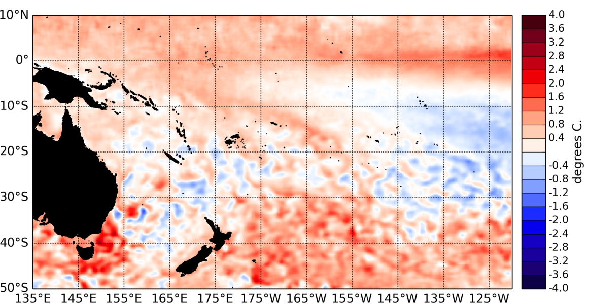
The Pacific Ocean carried on being borderline between neutral and weak El Niño conditions in June 2014. El Niño like patterns are discernible in the ocean, however the atmosphere is yet to respond in a manner consistent with El Niño.
Sea surface temperatures (SSTs) continued to be warmer than normal in the NINO regions, but there is currently no large difference in anomalies between the east and west Pacific, the ocean being warmer than normal all along the Equator.
The latest monthly anomaly values for all NINO indices continue at or above usual El Niño thresholds: 0.53°C for NINO3.4, 0.9°C for NINO3, and 0.64°C for NINO4.
Warm anomalies in the subsurface ocean still exceed +4°C east of about 110°W at about 50m depth, but the ocean has been slowly loosing heat to the atmosphere without the latter showing a response typical of El Nino.
The Southern Oscillation Index (SOI) is at –0.3 for June 2014 (neutral), and the latest value for the TRMM ENSO index for the 30 days to 2 July is in the neutral range (–0.08).
The Intertropical Convergence Zone (ITCZ) was intensified especially at and around the Dateline. The South Pacific Convergence Zone (SPCZ) was weaker than normal and restricted to the far western Pacific. A large area in the south Pacific (from the southern parts of the Solomon Islands to east of Samoa) consequently experienced anomalously low rainfall last month.
The Madden – Julian Oscillation (MJO) was inactive in the last two weeks of June. The forecasts (CPC) indicate normal or reduced levels of intra-seasonal convective activity over the next two weeks.
The consensus forecast from IRI / CPC indicates that El Niño is the most likely outcome (70 % chance) over the July to September 2014 period. Chances for El Niño increase further to reach 82% in October – December 2014.

