
-

River Environment Classification
Research ProjectThe River Environment Classification (REC) is a database of catchment spatial attributes, summarised for New Zealand's river network. The attributes were compiled for the purposes of river classification, while the river network description has been used to underpin models. -

Modelling channel dynamics in braided rivers
Research ProjectNIWA are contributing to and testing the open source Delft3D model so that it can be used to simulate the response of braided rivers and their ecosystems to the changes in river flow associated with water use schemes, such as dams. -
Water - managing our most precious resource
Farms rely on, and affect, the rivers, streams and estuaries around them. We provide resource management, research and technology services to help you optimise your water use and minimise environmental impacts. -

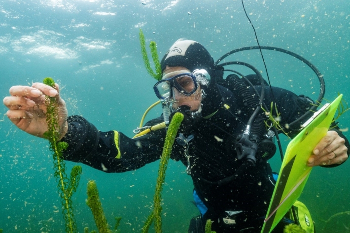
Mapping our freshwater biodiversity
Research ProjectThe ability to properly manage our freshwater resources requires a solid understanding of the flora and fauna which live in and interact with them. -
Summer Series 4: Life in the (ex) stream - exploring New Zealand's fabulous freshwater fauna
News article15 January 2013Our freshwater fauna are wonderfully diverse and, according to NIWA Freshwater Ecologist Dr Richard Storey, there's nothing among them that we need to be afraid of. -
LakeSPI method summary
A summary of the LakeSPI method. -
Reporting guidelines
LakeSPI delivers information that is directly applicable to lake-ecosystem conservation and management. -

Uses of LakeSPI
LakeSPI can be used in many ways depending on what the interests or management needs are for a lake. -

How LakeSPI works
LakeSPI (Lake Submerged Plant Indicators) is based on the principle that New Zealand lakes can be characterised by the composition of native and invasive plants growing in them, and the depths to which these plants grow. -

Staying ahead of water weed invasions
Research ProjectAquatic systems are under threat due to the introduction of invasive exotic species such as water weeds. Modelling work by NIWA has provided new information on which water bodies may be at greatest risk.