-

LakeSPI method summary
A summary of the LakeSPI method. -
Reporting guidelines
LakeSPI delivers information that is directly applicable to lake-ecosystem conservation and management. -

Uses of LakeSPI
LakeSPI can be used in many ways depending on what the interests or management needs are for a lake. -

How LakeSPI works
LakeSPI (Lake Submerged Plant Indicators) is based on the principle that New Zealand lakes can be characterised by the composition of native and invasive plants growing in them, and the depths to which these plants grow. -

Sediments and mangroves
Research ProjectMangrove forests, which are important parts of estuarine ecosystems in a number of ways, are sensitive to changing sea level. -
New Zealand Coastal Society Annual Conference: ‘Making Waves, 20 years and beyond’
News article14 November 2012 -
How prepared are we for a major marine earthquake?
News article14 November 2012 -
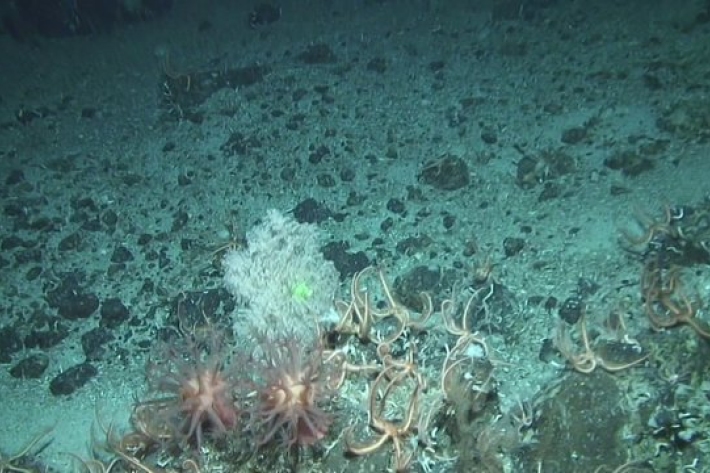
DTIS - Deep Towed Imaging System
DTIS is a camera system designed and built by NIWA staff, which is used to take pictures and video of deep sea biodiversity and seafloor habitats at depths of up to 6km. -
Significant Letter of Intent signed between world leading research organisation NOAA and NIWA
News article12 November 2012 -

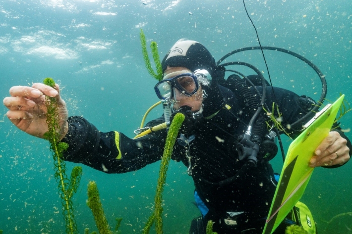
Staying ahead of water weed invasions
Research ProjectAquatic systems are under threat due to the introduction of invasive exotic species such as water weeds. Modelling work by NIWA has provided new information on which water bodies may be at greatest risk.