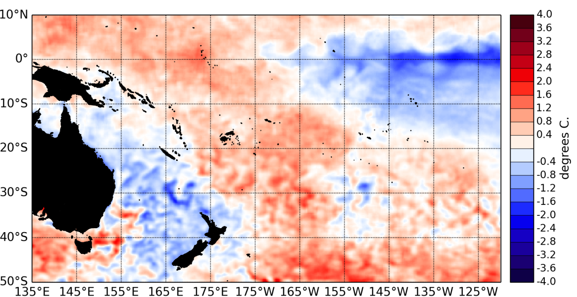
The tropical Pacific Ocean remained in a neutral state (neither El Niño nor La Niña) in February 2014.
The central and eastern Pacific has cooled further in February compared to January. Both the NINO3.4 and NINO3 sea surface temperatures (SST) indices are currently negative (respectively –0.36 and –0.55°C). The NINO4 index (in the western Pacific) remains weakly positive at 0.28°C for February.
The large area of higher- than-normal SSTs that has been a persistent feature of the central east Pacific has weakened and shifted eastward compared to January.
Subsurface waters are currently much warmer (up to + 4°C ) than normal in the western and central Pacific at about 150m. deep, while slightly cooler than normal waters are present at about 50m deep in the eastern Pacific.
A very strong westerly wind anomaly (westerly wind burst) affected the western Pacific over the last week of February. This was associated with an intense Madden–Julian Oscillation (MJO) pulse.
The Intertropical Convergence Zone (ITCZ) was shifted north of its climatological position throughout the Pacific. The South Pacific Convergence Zone was shifted southwest of its climatological position.
The latest value for the TRMM ENSO index for the 30 days to 3 March is 0.36.
The Southern Oscillation Index (SOI) is slightly negative at –0.3 for February 2014.
An intense MJO event affected the western Pacific in the last week of February. The MJO forecasts for the next two weeks are in disagreement so no clear guidance can be provided this month with regards to the intra-seasonal convective activity in the Pacific over the next two weeks.
The consensus forecast from IRI / CPC indicates that neutral ENSO conditions are likely to persist over the March – May 2014 period, with 87 % chance, versus 8 % for La Niña and 5 % for El Niño.

