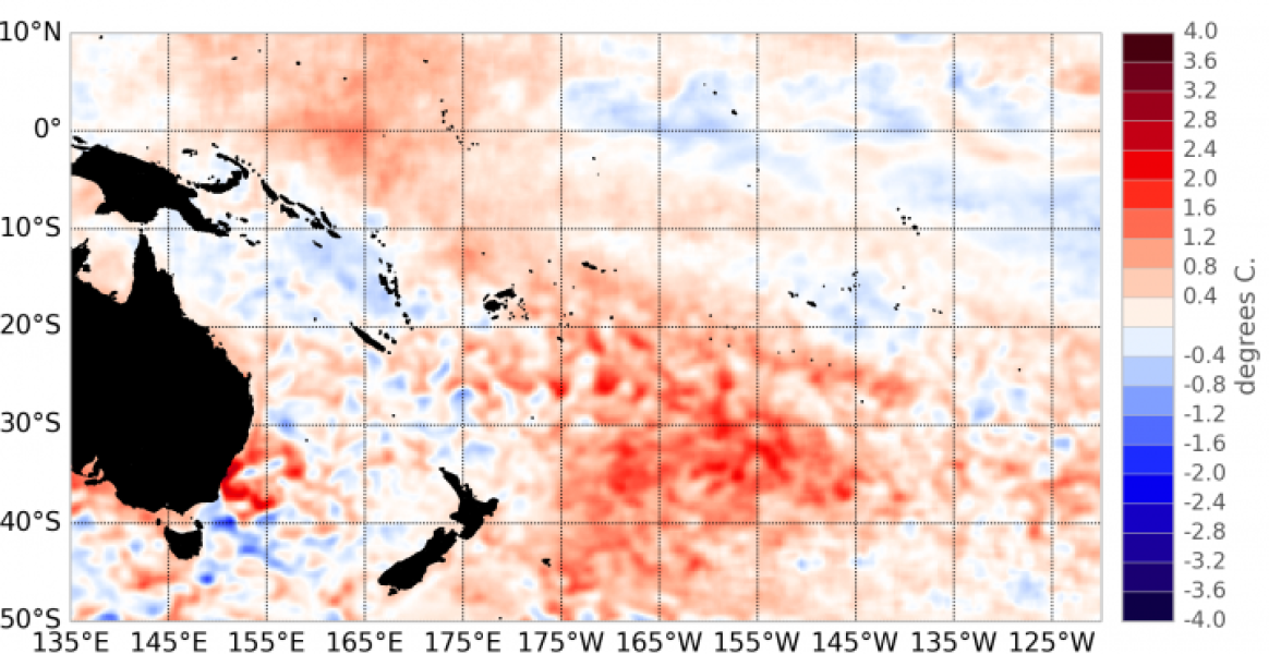
The tropical Pacific remained in a neutral state (neither El Niño nor La Niña) in October 2013.
In contrast to previous months, the eastern equatorial Pacific is now slightly warmer than normal. The western Pacific continues to be warmer than normal, while the central Pacific displays slightly negative anomalies.
The NINO 4 sea surface temperatures (SST) index (in the western Pacific) presents the largest anomalies at 0.3°C for October, while NINO 3 is close to 0 and NINO 3.4 is negative at – 0.17°C.
SSTs continue - for the 6th consecutive month - to be higher than normal over a large area in the central south Pacific, extending from Fiji to the northeast of New Zealand. On the other hand, the lower than normal SSTs around French Polynesia have now vanished.
The subsurface ocean is warmer than normal at about 125 m deep west of the Dateline, and a shallow layer of warmer than normal ocean temperatures is also present in the far eastern Pacific.
The trade winds remained close to normal in October. The Intertropical Convergence Zone (ITCZ) was not well defined in October. The South Pacific Convergence Zone (SPCZ) was intensified over its northern edge and extended further east than normal.
The latest value for the TRMM ENSO index for the 30 days to 3 November is –0.09 (compared to -0.46 in September).
The SOI is currently slightly negative (– 0.3 estimate for October).
The Madden – Julian Oscillation (MJO) was mostly inactive in the western Pacific in October and is forecast to remain so over the next two weeks.
The ensemble of dynamical and statistical climate forecast models that NIWA monitors indicates that neutral ENSO conditions are extremely likely to persist over the November 2013 – January 2014 period, with 93 % chance, versus 6 % for La Niña and only 1 % chance El Niño.

