-

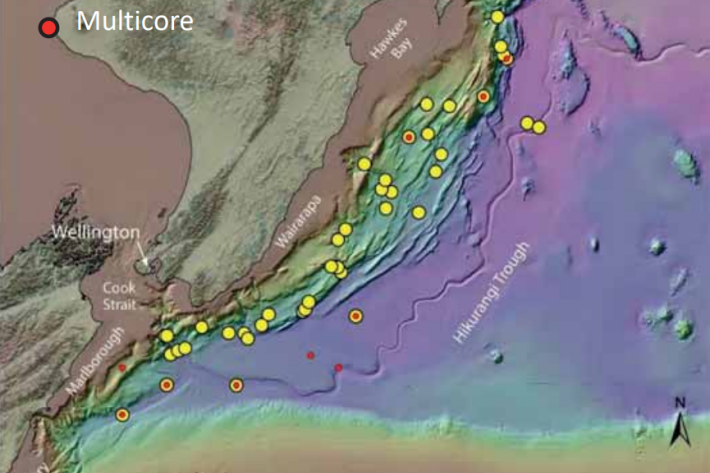
Scientists set to delve into the secrets of the Cook Strait mega-canyon
News article06 June 2017 -

RV Ikatere
FacilityA versatile inshore vessel, RV Ikatere is equipped with high-precision multibeam and sub-bottom profiler transducers for surveying and mapping the seabed. -

RV Kaharoa
FacilityKaharoa is capable of working throughout New Zealand's EEZ and further afield. -

2017 - Canterbury plains groundwater
VoyageRV Tangaroa Voyage TAN1703
5 April – 1 May 2017
-

2017 - Chatham Rise biodiversity
VoyageQuantifying Benthic Biodiversity: a factual voyage report from RV Tangaroa voyage TAN1701 to Chatham Rise
4 January – 2 February 2017 -
2016 - Colville Ridge Geophysics voyage
VoyageThe main output of this voyage is providing data and fundamental base maps for future regional prospectivity surveys, tectonic plate reconstructions, and general understanding of the architecture of the Kermadec backarc. -

2016 - Otago multibeam
VoyageOtago Multibeam 2: Great South Basin and Southern Canterbury Shelf. -

2016 - Kermadecs biodiversity
The voyage to the Kermadec region is a collaborative expedition between NIWA, Auckland Museum, Kelly Tarlton’s, Department of Conservation, Auckland and Massey Universities, The PEW Charitable Trusts and Te Papa. -

NIWA completes first bathymetric mapping of Lake Tekapo
Media release17 March 2016NIWA researchers have spent part of the last month keeping a close eye on the bottom of Lake Tekapo to find out what it looks like and what is going on below the lake bed. -

Scientists delve deep into oceans’ climate secrets
News article21 January 2016NIWA’s research vessel Kaharoa carried out a three-week voyage to deploy the first Deep Argo floats to collect data on climate change at ocean depths of about 5700m. -

Kapiti multibeam survey
News article24 June 2015NIWA scientists use the latest multibeam echo-sounding technology to generate new charts of the seafloor around Kapiti island.

