The dynamical models are in agreement to forecast continuing, but progressively weakening El Niño conditions for the April – June 2016 period (80% chance).
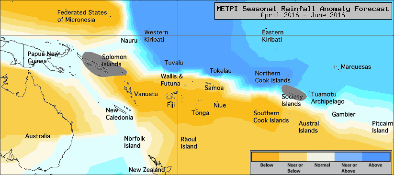
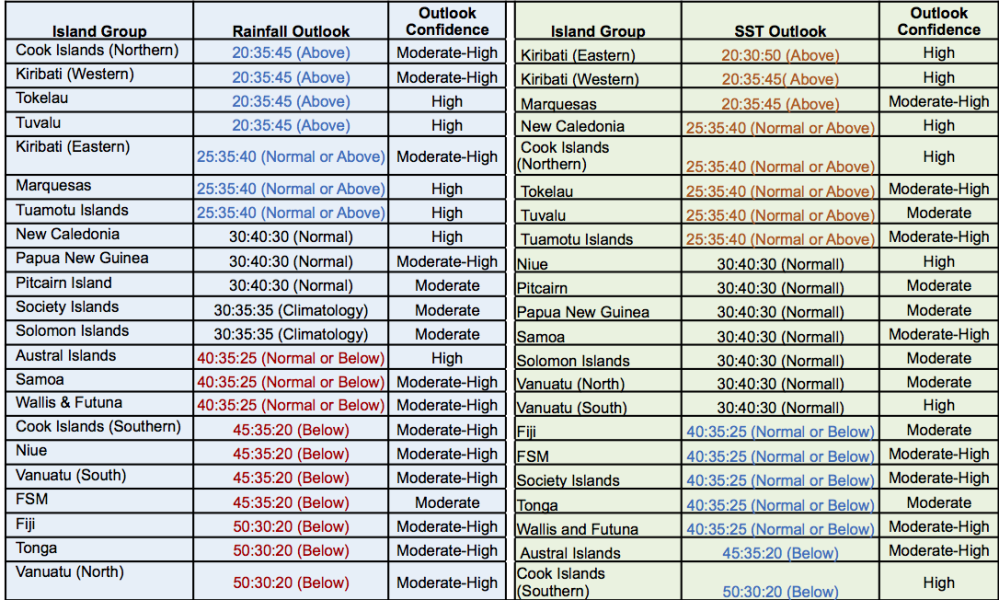
The large-scale precipitation pattern anomaly for the next three months still broadly reflects typical El Niño impacts. Below normal rainfall is forecast for the southern Cook Islands, Niue, southern Vanuatu, the Federated States of Micronesia, Fiji, Tonga and northern Vanuatu. Normal or below normal rainfall is forecast for the Austral Islands, Samoa and Wallis & Futuna. Near normal rainfall is forecast for New Caledonia, Papua New Guinea and Pitcairn Island. Normal or above normal rainfall is forecast for eastern Kiribati, the Marquesas Islands and the Tuamotu archipelago. Above normal rainfall is forecast for the northern Cook Islands, western Kiribati, Tokelau and Tuvalu. No clear guidance is available this month for the Society Islands and the Solomon Islands.
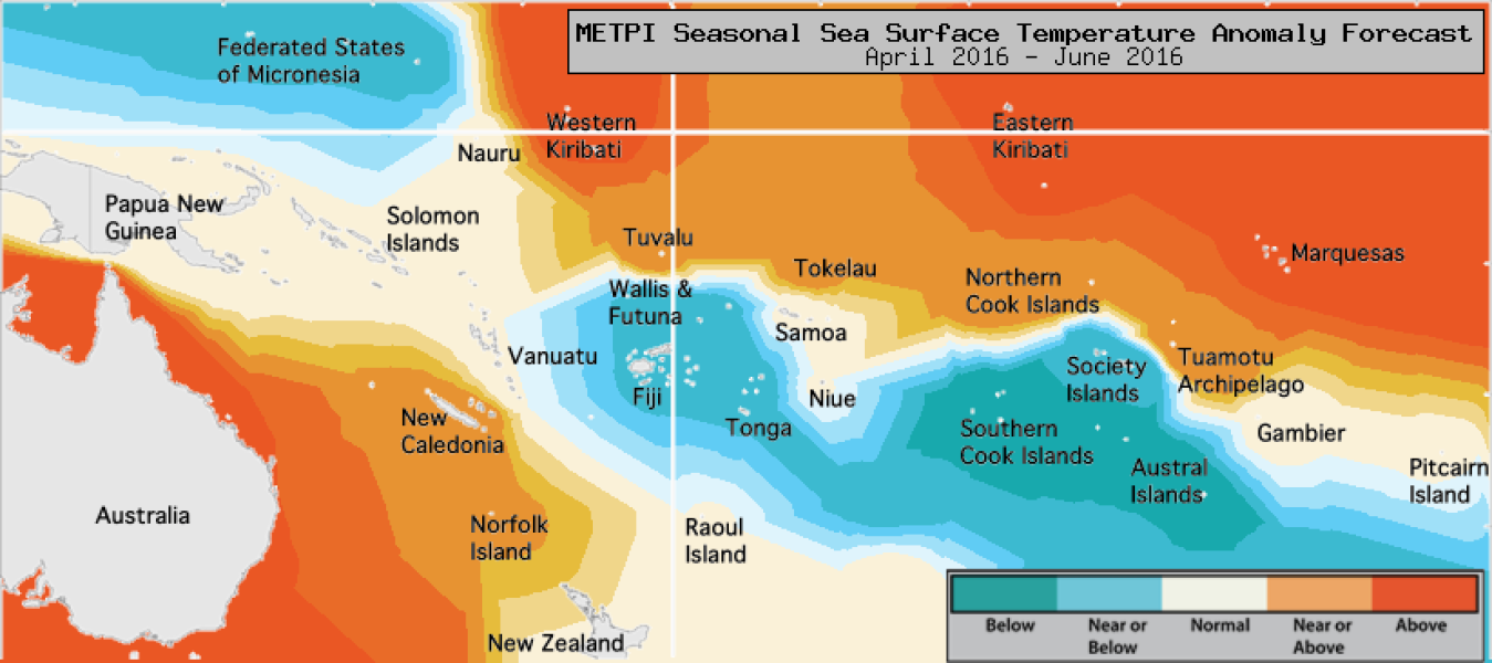
Despite the current El Niño forecast to weaken further over the forecast period (April – June 2016), Sea Surface Temperature (SST) in the eastern and central Pacific are still expected to remain higher than normal for the season as a whole. The region of cooler than normal SSTs present in the south Pacific is forecast to persist, while SST south and east of Australia are forecast to be well above normal. Above normal SSTs are forecast for western Kiribati, eastern Kiribati and the Marquesas. Normal or above normal SSTs are forecast for New Caledonia, the northern Cook Islands, Tokelau, Tuvalu and the Tuamotu archipelago. Normal or below normal SSTs are forecast for Fiji, the Federated States of Micronesia, the Society Islands, Tonga and Wallis & Futuna. Below normal SSTs are forecast for the Austral Islands and the southern Cook Islands. The average region-wide hit rate for rainfall forecasts issued for the April – June season is about 59%, 4% below the average for all months combined. The confidence for the SST forecasts is also moderate to high.


