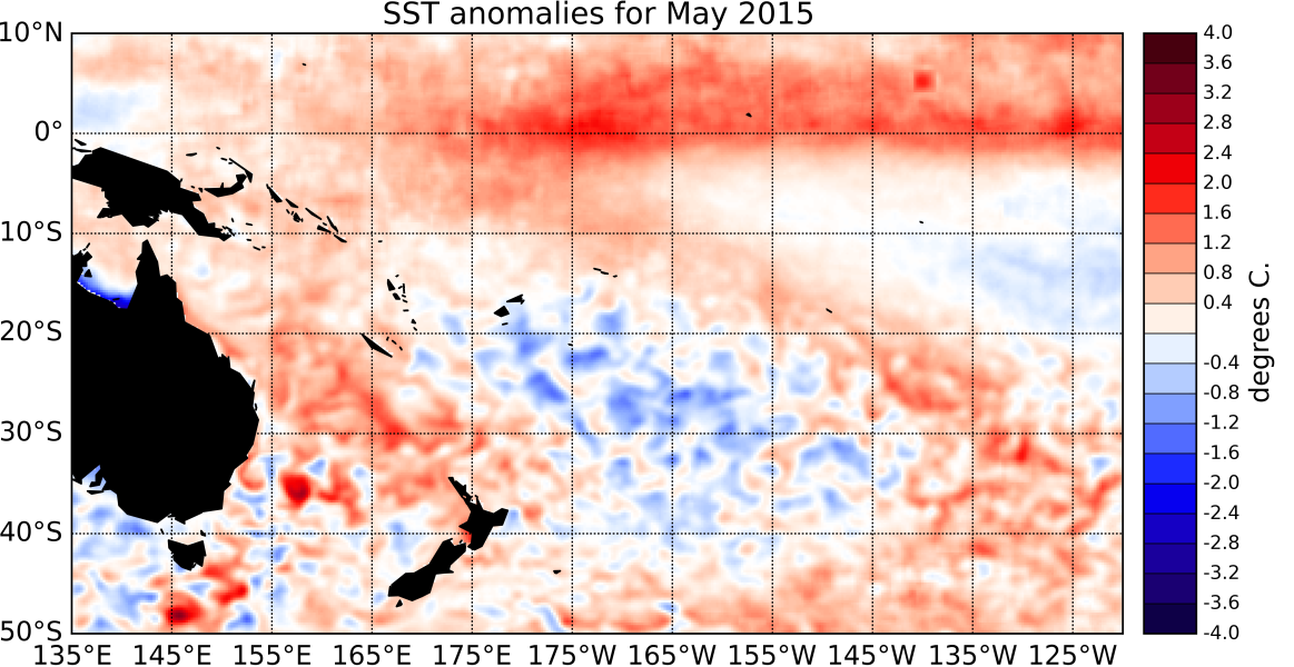
Sea Surface Temperatures (SSTs) have increased considerably in the eastern Pacific and are showing a pattern typical of El Niño. The SOI has dropped further in the negative and is at -1.2 for May 2015.
Convection and rainfall anomalies along the Equator are also indicative of an active coupling between the Ocean and the Atmosphere, with dry conditions over the Maritime Continent and wetter than normal conditions over and to the east of the International Dateline. The ENSO Precipitation Index (ESPI) is over the El Niño threshold at +1.85 (value to the 3rd of June). Monthly SST anomalies are currently above the 1°C mark in all of the NINO regions: The NINO3.4 index value is +1.1°C, NINO4 (in the west-central Pacific) is currently at +1.1°C and the NINO3 index (in the eastern Pacific) has seen a dramatic increase during May 2015, and now reaches +1.2°C above normal.
Sub-surface ocean temperature anomalies in the eastern Pacific have intensified further and now exceed +5°C between 50 and 100m depth off the South American coast (east of ~110°W). In the western Pacific (west of ~160°E), negative anomalies are present between 100 and 200m depth. Positive upper ocean heat content anomalies (upper 300m of the Ocean) have intensified in the eastern Pacific and now reach more than +2.5°C off the coast of South America.
The Madden-Julian-Oscillation (MJO) was mostly inactive in the region during May 2015. At the forecast horizon of 14 days, both the dynamical and statistical CPC forecasts indicate that intra-seasonal convetive activity will remain weaker than normal in the western Pacific. International guidance indicates that El Niño conditions are very likely (90% chance) to continue over the next three months period (June – August 2015). The likelihood of El Niño persisting or strengthening as we reach into spring is also very high (above 80%).

