Intense competition for water is putting pressure on the life-giving resource, elevating demand for expert research to improve water management systems.
In response, NIWA’s Environmental Flows (eFlows) programme has developed the Catchment Streamflow Depletion Model.
The model is an interactive online app which can provide an overview of surface and groundwater use from a particular stream, aquifer or catchment.
It considers surface flow and groundwater flow together because in many catchments, they are closely coupled.
This means that the model can represent a combined water system, acknowledges the integrated nature of surface and groundwater, and assists with managing them as a single resource, critical to sustain people as well as aquatic and terrestrial ecosystems.
What is streamflow depletion?
Abstraction of water from groundwater (aquifers) and surface water bodies (rivers and streams) reduces natural streamflow, which is defined as streamflow depletion.
The depletion due to the surface water abstractions can be easily measured as they instantaneously deplete the stream.
However, the impact of groundwater abstractions on streamflow is complex.
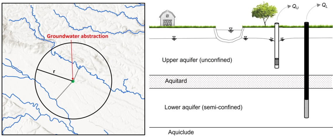
The rate (and extent) of stream depletion due to groundwater abstraction depends on many factors, including: distance from the stream, pumping rate, bore depth, and aquifer hydraulic properties.
Abstraction of groundwater reduces the discharge of groundwater into streams and increases loss of water from the stream to the aquifer (recharge).
These changes occur as hydraulic gradients between aquifer and stream are increased due to reduction in groundwater level – both these phenomenon cause streamflow depletions.
What can the model do?
The model can be used to estimate streamflow depletion at any reach of the stream network, simulates streamflow depletion due to both surface and groundwater abstractions, and can be used to estimate cumulative streamflow depletion down a catchment.
The model can help inform important decisions made by council water managers, catchment groups and hydroelectric generators, in particular help answer questions such as “how much water could be allocated sustainably”? Model estimates also provide valuable insights and information that could be used for national water research and environmental reporting.
How does it work?
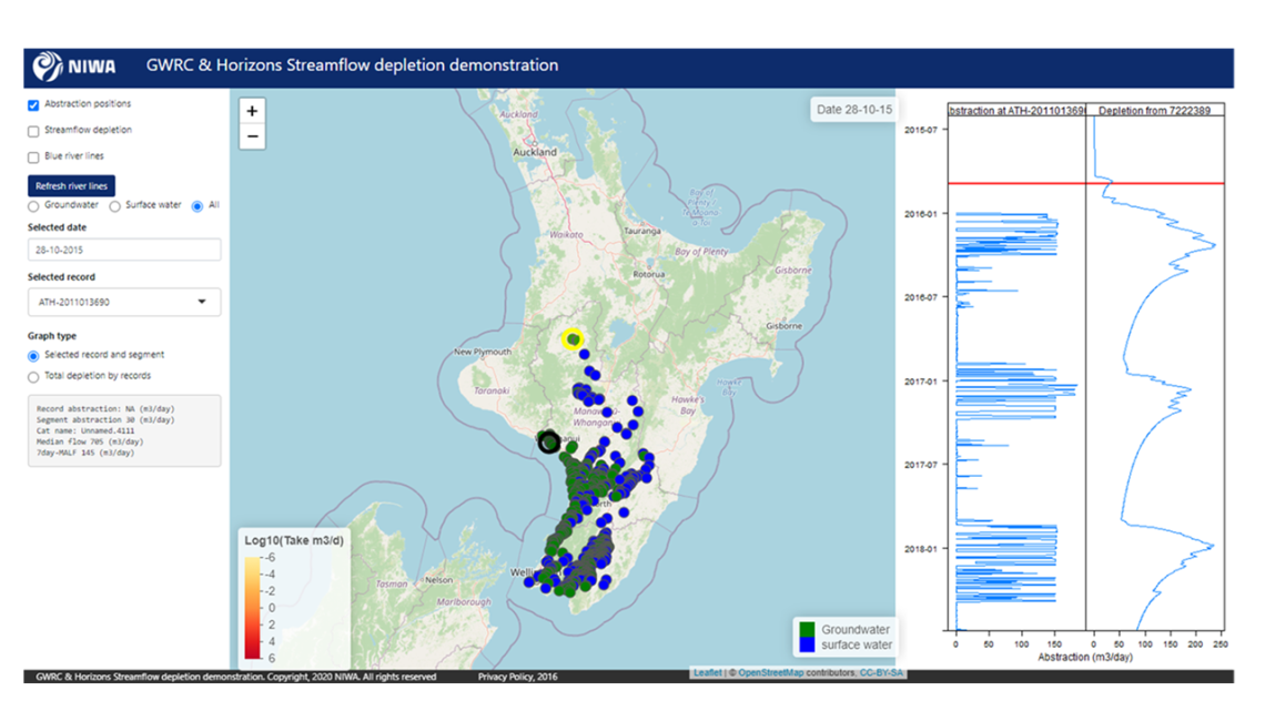
Users can view groundwater and surface water points, together or separately.
The user selects a particular point in a stream, and the model then determines the distance from that point to nearby water extraction sources. It provides a time-series estimate of the cumulative streamflow depletion (the rightmost panel in Figure 3) resulting from all the observations at and above the river reach in graphical form, along with other information.
Models can be optimised for a region or catchment. It has already been set up in trials at regional scale for Wellington, Manawatū-Whanganui and Canterbury and catchment scale for Hauraki in Waikato.
Staff involved in this project: Channa Rajanayaka, Doug Booker, Jing Yang and Rasool Porhemmat.
For more information on this project and using the Streamflow Depletion tool contact Channa Rajanayaka.


