Scientists across NIWA use specialist tools manufactured across the world to perform their research and environmental consultancy. Here are some of the advanced instruments that help keep NIWA on top in its field.
-

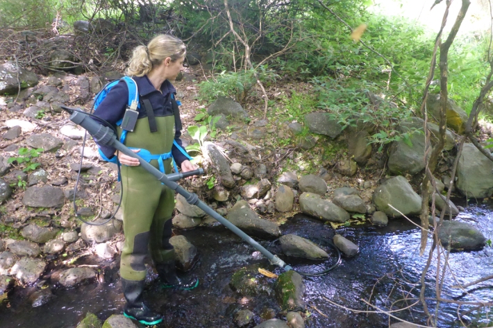
Acoustic and radio telemetry
Radio and acoustic tracking of fish (or any animal) allows the movement and activity of animals to be recorded over the life of the transmitter (battery size dependent). -

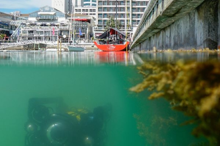
ROV (remote operated vehicle) for marine biosecurity surveillance
Hazardous and murky conditions in our ports and marinas can make it challenging for divers to carry out important biosecurity inspections for introduced pest species. NIWA scientists are pioneering the use of underwater remote operated vehicle (ROV) technology to improve surveillance checks. -

Computerised Research Echo Sounder Technology (CREST)
Our Computerised Research Echo Sounder Technology (CREST) is a highly adaptable approach to fisheries and other acoustic data acquisition. -

Flow Cytometer
NIWA's Becton Dickinson FACSCalibur flow cytometer supports a wide range of research and commercial applications. -

Multibeam swath system
Hull-mounted on the RV Tangaroa, the EM302 multibeam echosounder maps the seafloor using a fan of 288 acoustic beams, producing up to 864 soundings per ping in dual swath mode, providing 100% coverage of the seabed. -

Trimble RTK GPS systems
NIWA uses Trimble RTK GPS surveying equipment to undertake precise topographic and bathymetric surveys. These surveys are used to measure beach stability, river bed erosion and deposition, and to make digital terrain models of rivers for 2-dimensional hydrodynamic modelling. -

Multi Channel Seismic (MCS) System
Modern marine geoscience requires accurate and detailed subsurface information for the mapping of geologic structures and sedimentary sequences beneath the continental margin. In order to acquire this information NIWA purchased a Multi Channel Seismic system (MCS) in December 1996, consisting of a 24 channel streamer, seismic source and acquisition hardware. -

Mobile air quality monitoring trailers
NIWA's mobile air quality monitoring trailers contain equipment capable of measuring a range of key air contaminants and meteorological parameters. -

DTIS - Deep Towed Imaging System
DTIS is a camera system designed and built by NIWA staff, which is used to take pictures and video of deep sea biodiversity and seafloor habitats at depths of up to 6km. -

PIT tagger
Passive Integrated Transponders (PIT) are used to tag fish (or any animal) for life. -

Instrumentation at NIWA Lauder
FacilityThere is a wide range of instruments at Lauder, which are listed on this page.
Resources
-

Alice: an Instrumented Tripod
Alice is an instrument package for measuring bottom-boundary-layer processes in estuaries and the ocean. It consists of a self-ballasted tripod upon which is mounted a "core" sensor package for measuring boundary-layer currents, turbulence and waves. Alice is principally rigged for sediment-transport studies (with optical and acoustic backscatter sensors, sediment traps and a pump sampler) but has also been used extensively in studies of boundary-layer mechanics, animal–flow–sediment interactions, wave dynamics and nutrient/gas fluxes. -

Benthic Ecology Video Information System
BEVIS has been developed for rapid, cost-effective seafloor habitat surveys. Sled-borne cameras are monitored and controlled from the surface, affording investigation at depths where using divers to collect video data or macrobenthic cores would be impractical or impossible. -

Eqns
Mass of Seawater = w(sw) [kg]
Volume of Manometer = Vman [cm3]
Manometer Temperature = T [°C]
Manometer Pressure = Pfinal [Pa]
Pressure transducer zero = Po [Pa]
Universal Gas Constant = R = 8.314 J K-1 mol-1
Virial Co-efficient B(CO2) [cm3 mol-1] B = 1636.75+(12.0408*(T+273.16))-(0.0327957*(T+273.16)2)+(0.0000316528*(T+273.16)3)
Vm(CO2 at manometer T and P) [m3] – calculate iteratively, initial Vm = 0.22264 =R*(T+273.16)/((Pfinal - Po))*(1+(B*0.000001/Vm))
CT -
-

ROV (remote operated vehicle) for marine biosecurity surveillance
Hazardous and murky conditions in our ports and marinas can make it challenging for divers to carry out important biosecurity inspections for introduced pest species. NIWA scientists are pioneering the use of underwater remote operated vehicle (ROV) technology to improve surveillance checks. -
-

Instrumentation at NIWA Lauder
FacilityThere is a wide range of instruments at Lauder, which are listed on this page.
