-
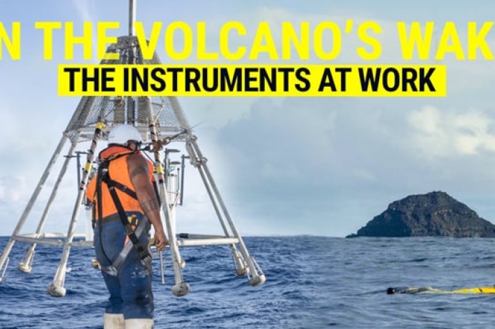
The instruments at work - In the volcano's wake
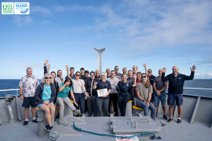
Our team onboard RV Tangaroa are equipped with all the tech and tools they need to explore the undersea changes caused by the devastating volcanic eruption in Tonga earlier this year. -

Open wide: snapper teeth secrets
NIWA and University of Auckland masters student Georgia Third is getting up close and personal with snapper guts and teeth to understand the differences between biologically distinct snapper populations in New Zealand. -

Voyage update - 2 May
Tangaroa has sampled more clean seawater from a site not affected by the January 15th eruption of Hunga Tonga-Hunga Ha’apai (HT-HH). -

Voyage update - 1 May
Tangaroa is off the west coast of Tongatapu collecting seawater to analyse for trace metal. -

Voyage update - 30 April
RV Tangaroa has just completed its last full day of sampling around the waters of Hunga Tonga-Hunga Ha’apai (HT-HH). -

Voyage update - 29 April
Tangaroa is now 100 km south-west of Hunga Tonga - Hunga Ha’apai volcano (HT-HH), surveying in 2,440 m of water in the Lau Trough. -
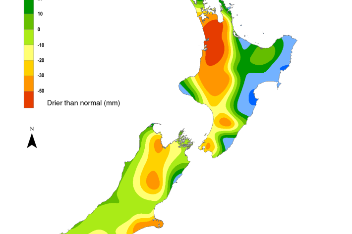
Hotspot Watch 29 April 2022
Hotspot29 April 2022A weekly update describing soil moisture patterns across the country to show where dry to extremely dry conditions are occurring or imminent. Regions experiencing significant soil moisture deficits are deemed “hotspots”. Persistent hotspot regions have the potential to develop into drought. -

Voyage update - 28 April
Tangaroa continues to map the area while deploying instruments to collect samples and capture images of the seafloor. -

Voyage update - 27 April
We started the day by examining the seafloor towards the main island of Tongatapu. As we got closer, the images from the seafloor clearly showed a layer of ash several centimetres thick overlaying the white bedrock of the main Tongan islands. -

Mt Potts electronic weather station (EWS)
Our highest elevation site at 2128 m, Mt Potts is also one our sites very exposed to wind. -

Upper Rakaia electronic weather station (EWS)
The Upper Rakaia SIN site is located at 1752 m on a north facing slope in the Jollie Range. Records start in 2010.