On the eve of entering the Ross Sea
Well, we are now two weeks into the voyage and while we have yet to enter the Ross Sea we have already seen so much! We are onboard RV Tangaroa with a team of 20 scientists and 18 crew, including a ship doctor and ice pilot, heading for the Ross Sea to study ocean physics, food web dynamics, subseafloor fluid systems and benthic ecology. It has been one and a half years in the making and it is finally happening. After five days living aboard the ship in Wellington in semi-isolation to limit the chance of COVID-19 infection onboard, we left Wellington Harbour on a perfect Sunday evening into a remarkably calm Cook Strait.
We took the first opportunity available to deploy the Continuous Plankton Recorder (CPR) off the stern fantail. The CPR will be towed throughout our voyage to study how zooplankton species abundances vary along our route through the Southern Ocean and into the Ross Sea. The CPR readings are regularly supplemented by deployments of Bongo nets to gather zooplankton samples.
I think it is fair to say everyone was a bit apprehensive about heading through the Roaring Forties, the Furious Fifties and the Screaming Sixties, however we had a perfect initial passage south with a gentle following sea.
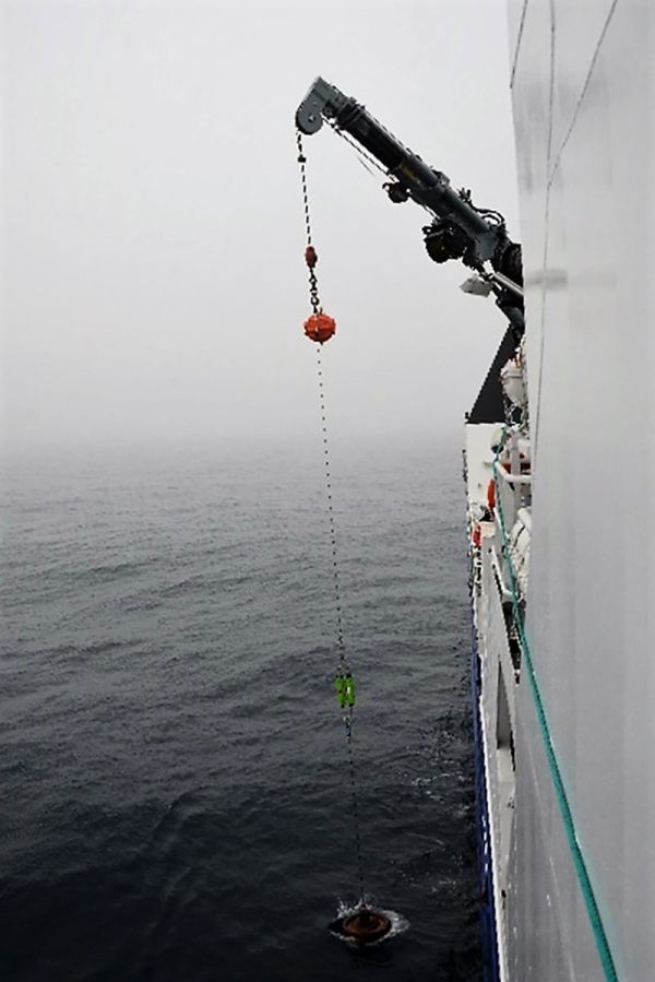
We reached our first Passive Acoustic Mooring (PAM) site after five days. The PAM moorings allow us to record observations at fixed locations over long time periods – including during winter when the region is inaccessible. There are 3 PAMs which have been listening for whales and other marine mammals for 6 years and we are redeploying them for another 2 years. This will be an amazing dataset for understanding the population and behaviour of a range of marine megafauna.
During transit we also deployed several Argo floats and surface drifter buoys that will float around the ocean taking measurements of ocean currents. Argo floats drift at depths of about 1,000m before dropping to 2,000m and then returning to the surface every 10 days, measuring temperature and salinity profiles as they ascend. After relaying profile data and location via satellite, the float sinks back down again to begin another cycle.
Once we crossed 60°S and officially entered Antarctic waters, we started our programme of daily morning water and plankton sampling. Using the Conductivity Temperature Depth Profiler (CTD), we can collect data about the water column up to 6km deep. The CTD can provide a wealth of physical, chemical, and biological information that researchers can use to understand important processes such as ocean mixing.
We spotted our first iceberg at 63°S, with Karl Safi winning an eclectic prize bag in the sweepstake. Those of us who have not been down this way before were unprepared for how majestic and dramatic the icebergs are, and it really built the excitement for heading further south.
When checking the long-range weather forecast in Wellington, I had noted a large low-pressure system predicted to spin up in the Ross Sea region. While you can only give limited credence to forecasts more than a few days out, the closer we got, the position and size of the system remained the same. By the time we got to the PAM it was clear we would have to dodge the system which was now forecast to stretch from Scott Base to New Zealand, with waves >10 m and > 150km winds. Not something we could move south into where we also must navigate icefields.
Fortunately, the system had a defined western edge, and we were able to move west to avoid the worst of it. While we did lose some time, moving back to the PAM site the day after the storm gave us clear blue skies, icebergs dotted around the ship and what seemed like constant whale sightings. Absolutely amazing! The details and location of each sighting is logged photographically as part of our cetacean research programme.
We had a fantastic sunset which we expect to be our last as we turn due south and head through the ice bridge into the Ross Sea and our main scientific working area.


