Hi all,
Day 20 and we are now more than halfway through the Ross Sea Life in a Changing Climate (ReLiCC) 2021 voyage on RV Tangaroa. Last week I was hoping for spectacular views above and below the water and I haven’t been disappointed!
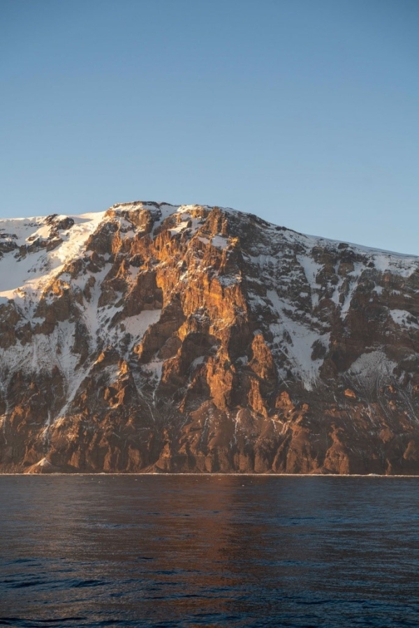
In between deploying the five oceanographic moorings, we had two days close to the coast at Cape Adare on Sunday and Monday. Here the Downshire Cliffs tower out of the water – sheers walls of rock and ice with interesting striations and bands of rusty red rock. I’m no geologist, but I’m sure somebody with the right training could read lots from the formations. The cliffs make the coast appear much closer than it actually is. You feel like you are only a kilometre offshore, but the radar says it’s still 20 km away! There are cliffs below the water too, and even though we worked in as close as we dared to the edge of the sea-ice with the ship’s multibeam echosounders, the water was still over 100 metres deep.
Our reason for coming close to the coast is to study the community of animals that live on the seabed. The nearshore coastal region of the Ross Sea, and particularly the Victoria Land coast, is recognised in the Ross Sea Region Marine Protected Area as an area of considerable ecological importance. Further, a recent analysis has suggested coastal benthic communities in Antarctica are likely to suffer greater effects of climate change than those offshore, making them valuable sentinels of change. But our understanding of what lives in these coastal waters is based mostly on a relatively small number of well-studied locations from Terra Nova Bay south to Ross Island, and typically at depths accessible by diving (i.e., less than 30 m). On this voyage, we are aiming to explore the depths from 30 to 200 metres along the seldom sampled northern Victoria Land coast in a project co-led by NIWA scientist Vonda Cummings and Miles Lamare from the University of Otago, and funded by the Antarctic Science Platform.
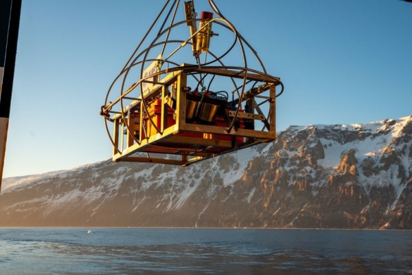
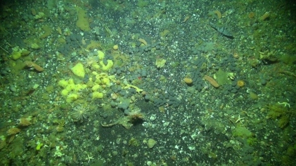
At Cape Adare, we were able to deploy NIWA’s deep-towed imaging system (DTIS) at four sites ranging in depth from 120 to 150 m. The video and still images from DTIS showed a rich community of sponges, hydroids, and starfish. Interesting the shallower sites were less ‘lush’ than the deeper ones, and there was evidence of scour left by large icebergs as they grind along the seabed.
We also deployed a small Boxfish remote operated vehicle (ROV) at one of the sites. The ROV pilot Leigh Tait had his hands full trying to drive the ROV in the strong currents, but Boxfish sent back some nice close-up images to complement those from DTIS.
No direct sampling of the seabed fauna was carried out because the Downshire Cliffs is a significant breeding site for seabirds. There was certainly an abundance of Adelie penguins and minke whales visible on the surface and our echosounders showed dense layers of krill beneath.
On Wednesday we visited a second coastal site at Possession Island. We arrived shortly after midnight to find the area clear of ice. By 4 am we had mapped the underwater bathymetry using the multibeam echosounders and selected four promising sites at depths of 50 to 100 m. But just as we were deploying DTIS, a large band of sea-ice appeared, driven by the strong surface currents and bearing down on us. We hurried and managed to get the DTIS near the bottom in 68 m depth for just 7 minutes before we were over-run by ice and had to abort. But in these 7 minutes of footage, we were treated to images of waving kelp-like seaweeds anchored to the ocean floor. It was exciting for us to see macroalgae in this abundance so deep. By 5 am the entire area of 2 km by 5 km that we had mapped was completely covered with ice! We managed to do two more DTIS drifts at 200 metres depth before heading offshore at 7 am to do our daily water sampling. When we returned 4 hours later we could not get near the coast due to extensive sea-ice!
The same thing happened again early this morning (Friday) at Cape Hallet. We got in close, made a multibeam map, but only had time for two DTIS runs in 90-120 m, before a band of sea-ice and icebergs drifted down from the north and covered our site. Just another illustration of what a difficult environment Antarctica is to work in – along with all the usual challenges of working at sea like weather and current, we’ve got ice to contend with as well!
We are hoping to sample more coastal locations over the next week. Between coastal sites, we are zig-zagging offshore running the underway systems and ship’s echosounders. One of the aims of this research is to study the distribution of Antarctic silverfish. Already we’ve detected and caught schools of adult and immature silverfish, and I’ll talk more about this fascinating species next week.
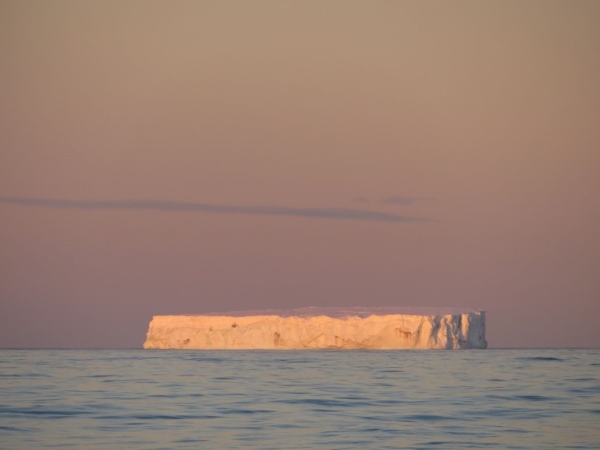
Everybody onboard is well and truly into our 24-hour sampling routine, although many are staying up on the bridge outside of their shifts to take in the scenery. Close to the coast, at 5 am, we’ve had a paparazzi of cameras trying to catch the morning light on the land, glaciers, and icebergs, or zoom in on the porpoising penguins, or distant whales. Our onboard videographer Stu Mackay has run tutorials for budding photographers, even setting homework (this week’s assignment was to capture the perfect iceberg image)! Stu was also lucky enough to get a ride in the man overboard (MOB) boat during a crew drill on Wednesday so he was able to look back at Tangaroa against the backdrop of Possession Island.
As I said in my previous reports, if you wish to track our progress please see https://niwa.co.nz/our-science/voyages/2021_Antarctica which will also have images from the voyage and more information on the science objectives. If you have any questions, you can e-mail direct.
Best wishes,
Richard


