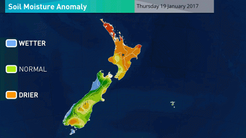
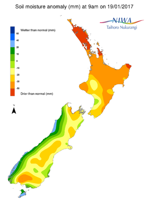
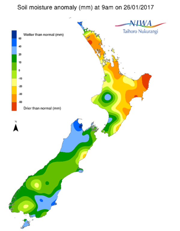
A weekly update describing soil moisture across the country to help assess whether severely to extremely dry conditions are occurring or imminent. Regions experiencing these soil moisture deficits are deemed “hotspots”. Persistent hotspot regions have the potential to develop into drought.

Facts: soil moisture
Across the North Island, soil moisture levels have increased during the past week. The increases were driven by an active front that crossed over the North Island between Saturday (21st Jan) and Sunday (22nd Jan). The most notable increases were observed in the Far North, Taranaki, Manawatu-Wanganui, and the Wellington region. The driest soils across the North Island compared to normal for the time of year are found in Kaipara and East Cape while the wettest soils for the time of year are found in the Ruapehu District and the southwest coast of Manawatu-Wanganui.
Hotspots remain in place across large portions of the North Island, including much of Northland and Auckland, northern and eastern Waikato (including the Coromandel Peninsula), and much of the east coast from Gisborne south to Masterton. Soils in these areas are severely drier than normal for this time of year. Hotspots across much of the Wellington region, South Taranaki District, and in southern and western Waikato have been alleviated for now.
Across the South Island, soil moisture levels have also increased during the past week. The most substantial increases were observed across the Tasman District, Nelson, Marlborough, interior Canterbury, Otago, and Southland where soils were quite dry this time last week. The increases were caused by two strong storm systems in the past week, one in the mid-week and the other over the weekend. As a result, hotspots have mostly been alleviated except in northern Canterbury, where a small hotspot remains.
Outlook and soil moisture
For the North Island, very little rainfall is expected over the next week. Some locations in the north and east of the North Island, particularly Northland, Hawke’s Bay, and Gisborne, may receive no measurable rain during the next seven days. Isolated showers are possible across Wellington, Manawatu-Wanganui, Taranaki, and western Waikato from Sunday night into Monday with amounts generally 3 mm or less. A few showers are possible in the aforementioned regions toward the latter stages of next week, though rain amounts are expected to be quite light.
Therefore, existing hotspots in the north and east of the North Island are forecast to grow in both coverage and intensity. The most dramatic decreases are expected across Hawke’s Bay, Gisborne, and Northland. Hotspot conditions may redevelop across the southwestern North Island where recent rains have alleviated the very dry conditions.
Across the South Island, the most substantial rain in the next week will be found along the West Coast through Fiordland. Rainfall along the east coast is likely to be below normal for the time of year with near normal rainfall elsewhere. On Friday, patches of rain will total 5-15 mm along the West Coast, Fiordland, much of Southland and southern Otago. Dry Saturday, then rain Sunday totalling 25 to 50 mm from Fiordland through the middle West Coast. Along the upper West Coast, much of Southland, and southeastern Otago rainfall will total 5-15 mm on Sunday. Mostly dry elsewhere on Sunday, then dry everywhere on Monday. Some more rain is possible for the West Coast, Southland and Otago from Tuesday into Wednesday. Showers may persist across western areas to round out the week, with very little reaching over the divide (less than 5 mm) from mid-Canterbury through to Marlborough.
Soil moisture levels are likely to decrease from mid-Canterbury through Marlborough over the next week with hotspot expansion (in the Hurunui District) and development possible elsewhere. Elsewhere, soil moisture levels are most likely to remain steady or decrease slightly over the next week. However, hotspots are unlikely to redevelop across Southland and Otago over the next week.


