One of the challenges for managing marine resources is predicting how different organisms in our marine ecosystems will respond to future environmental changes and human activities.
The scientific advice which people use to manage these systems normally evaluates impacts or change by looking at one effect at a time. Examples include using single species assessment models to understand the effects of fishing, or evaluating the impacts of climate change on individual species to understand how their populations will change over time.
This is changing, though. A new generation of fully-integrated ecosystem models is allowing us to understand what happens to an entire ecosystem when multiple impacts and activities happen simultaneously.
Atlantis is one of the best ecosystem modelling platforms in the world. It uses a wide range of marine ecosystem data, and we can use it to predict how these systems will look in the future. At NIWA, we’re looking at how our marine systems are going to respond to impacts like:
- fishing
- climate change
- the potential impact of pollutants and oil spills
- human-caused changes in the sea floor habitat from fishing and mining activities.
Atlantis is an end-to-end modelling system. This means that it mimics everything from the sunlight at the start of the system, to fisheries marketplaces. It takes all the parts of the marine ecosystem into account, as well considering human social and economic components.
Atlantis was developed in Australia by CSIRO. We are working with a large group of international scientists who’re developing Atlantis models for key ecosystems in their parts of the world.
Components of an Atlantis model
Atlantis splits an area into polygons (boxes) and depth layers. These splits are chosen to capture important characteristics like bottom type, temperature and past fishing activity.
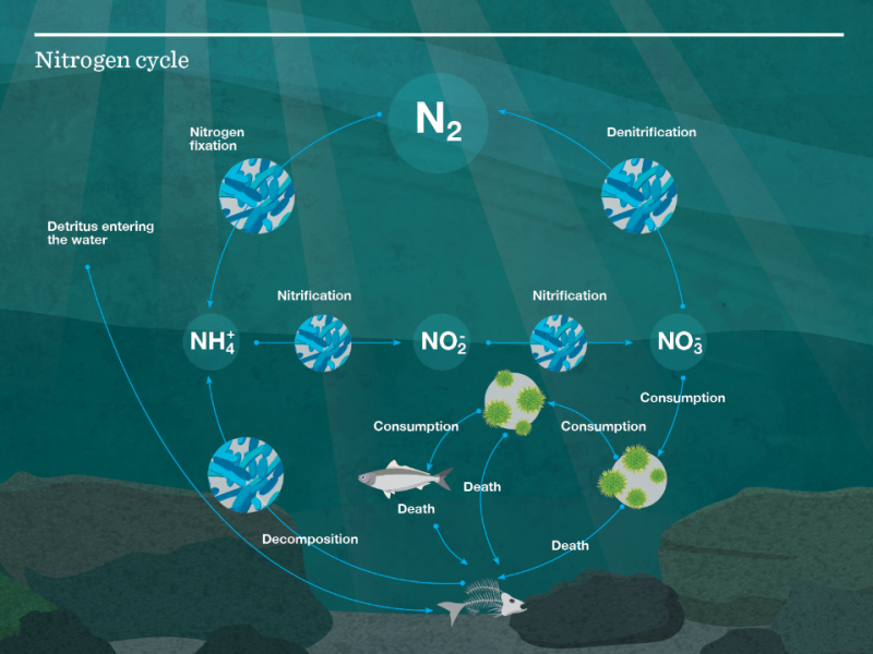
An ecosystem model needs a currency – a consistent unit which can be used to track the transfer of energy throughout the system. Atlantis models use nitrogen, which is one of the most important and often limiting nutrients in marine systems. The nitrogen cycle is complex, cyclical and continuous. Biomass is tracked in mg N/m3 (milligrams of nitrogen per cubmic metre). When a fish eats another fish, for example, nitrogen is transferred from prety to predator, with some also going to detritus and carrion.
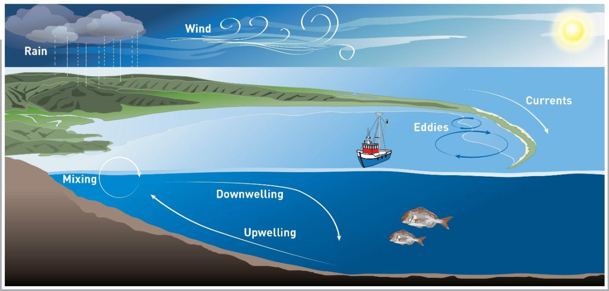
Water currents across each polygon control the movement of nutrients. Within each box, temperature and salinity are set for each time step. These physical parameters are outputs from a model which uses the Regional Oceanography Modeling System.
The Regional Oceanography Modeling System
In the model, species are grouped based on similarities in things such as habitat, diet, migration, growth, recruitment and mortality. Some species – or example ones that are very abundant, distinct, or important to investigate on their own - are kept as a single-species group.
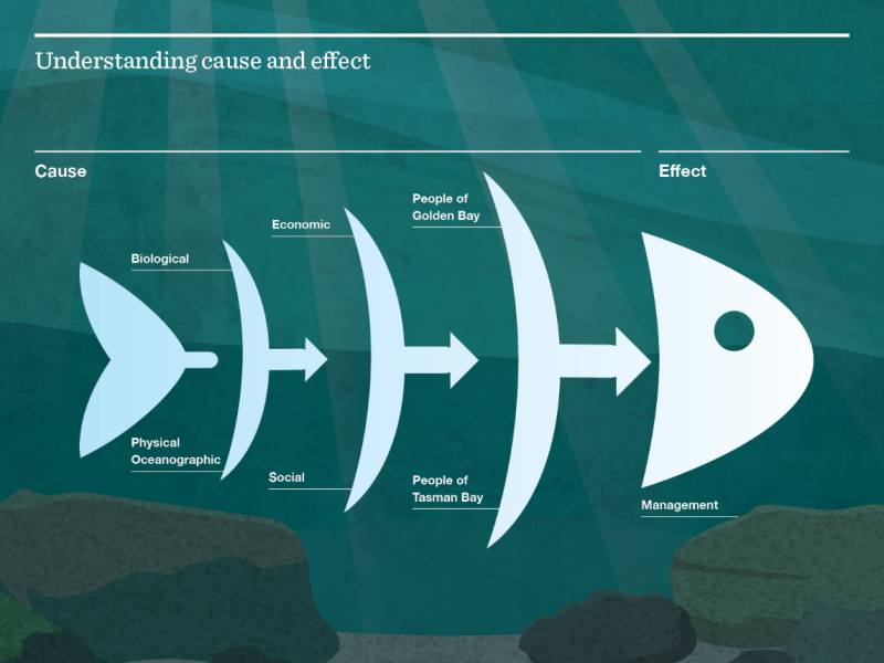
As well as biological and oceanic components, Atlantis models also include economic and social components.
Usage to date
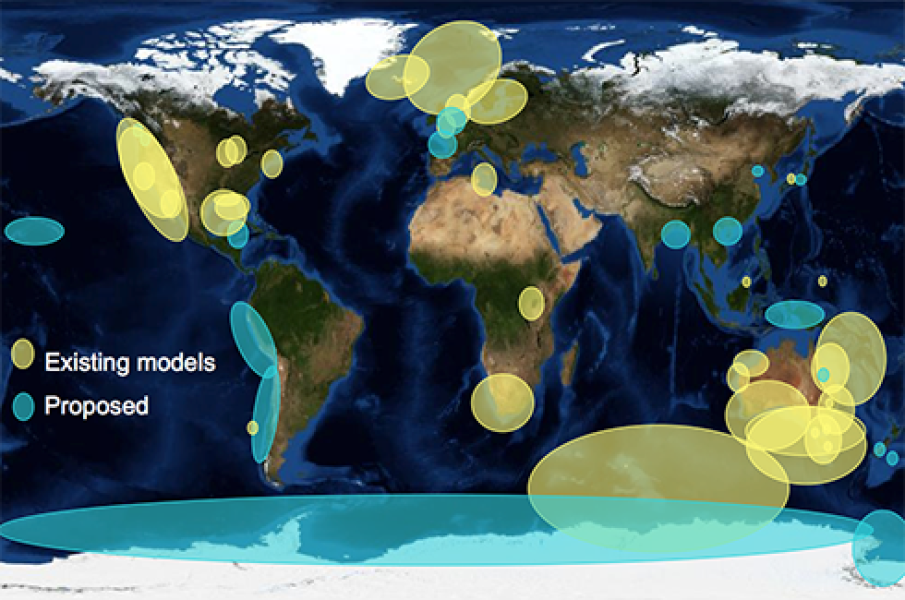
Atlantis has been used in more than 30 systems around the world, from small estuaries to large ocean regions (see image on right). Many of the models have been in temperate marine ecosystems, but there are also models for polar regions, tropical reeds and even lakes.
At NIWA, we’ve developed an Atlantis model for the Tasman and Golden Bays region. We’re also developing one for the Chatham Rise.
Tasman and Golden Bays
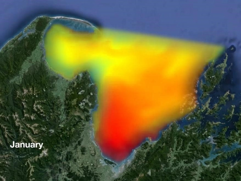
The Tasman and Golden Bays region is a relatively shallow, semi-enclosed system of bays. It supports a number of commercial fisheries and marine farms, as well as active recreational and customary fisheries. It’s also an important tourist destination and area for migratory birds.
To find out which socio-economic factors really matter for the region’s marine ecosystems, we’re talking with key organisations and stakeholder groups in the Nelson Bays area. We can use Atlantis to make predictions and help us understand what sort of decisions would be best by asking questions like:
- what scenarios do you want to see?
- what types of management do you want to consider?
- how do you want the future to look?
Chatham Rise
The Chatham Rise is a broad submarine ridge about 800km long and 300km wide that extends east from the New Zealand landmass into the southwest Pacific Ocean. It’s one of the most productive areas around New Zealand, as a result of warm, nitrate-depleted subtropical water mixing with cold, nitrate-rich subantarctic water.
The NIWA Atlantis team
Vidette McGregor (ecosystem modeller)
Vidette specialises in fisheries and ecosystem modelling. She has a Master’s degree in Statistics and Operations Research from Victoria University, and has worked as a Fisheries modeller at NIWA for three years.

